General Retrospection of a successful inspiration workshop on drone services in agriculture
Drone services such as weed, pest or disease detection in agricultural crops must be accurate, precise and have a fast turnaround time before they can be considered an operational service.
Drone data traditionally requires several days of processing (e.g. image stitching or georeferencing) and post-flight modelling before a spray application map can be created. For rapidly spreading diseases, weeds and pests, this is undesirable.
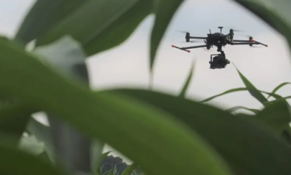
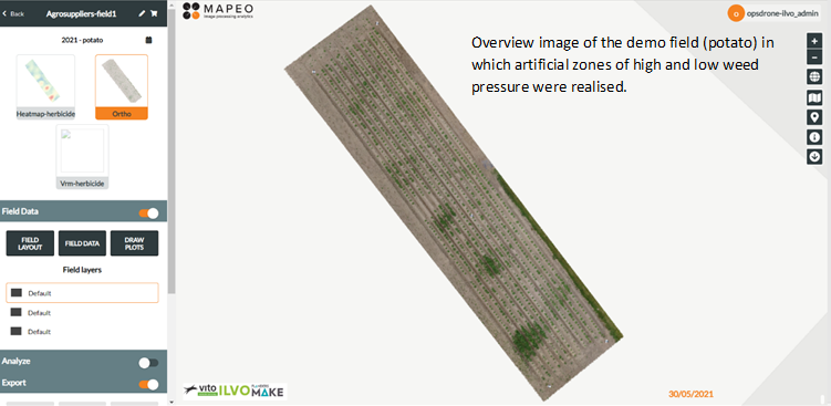
A case of real-time weed detection in both potatoes and maize was presented on January 12th 2023 at the inspiration workshop for suppliers at AgriFlanders. Both drone pilots and companies active in the agri-food industry enthusiastically participated in this workshop.
The rise of 5G, combined with direct georeferencing of aerial imagery significantly shorten computation time. Images are no longer stitched, but sent directly over the 5G network to the cloud. There, a deep learning model (convolutional neural network) can already give a score per images for the weed pressure present and link it with location of the image, while the drone is still performing its flight. As a result, a task map was already developed just 10 minutes after the drone flight and could be applied.
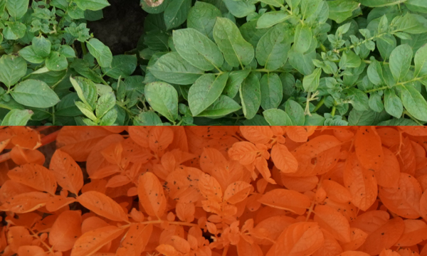
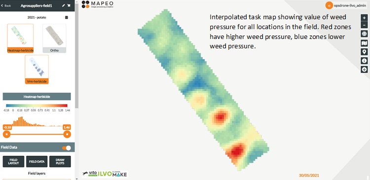
The predicted points layer (shapefile file) indicates the locations of the images in the field, with each point linked to a weed score. The values are interpolated across the field to obtain a score for each locations within the field.
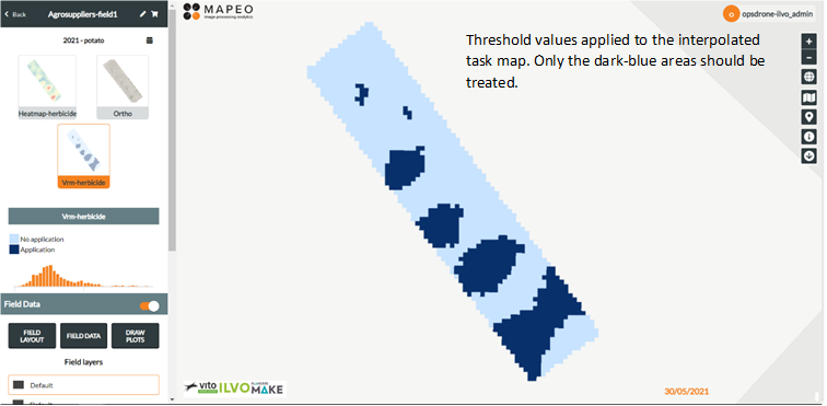
Threshold values are chosen to determine which areas have excessive weed pressure and need to be treated. These files (tif file) must be converted to a file type readable by the sprayer's on-board computer. Treating locally reduces the total amount of plant protection products or labour (mechanical weed control), which is good for the environment and the farmer.
The demo dataset, as well as the functional workflow to collect, analyse and process this drone data into task maps, will be made available to anyone who registers for the OpsDrone project. In addition, registered participants will have access to presentations, business cases and other OpsDrone project deliverables.
Those wishing to register can do so via the registration form.
Those who would like to stay informed about the OpsDrone project and new events and workshops can follow the group page.